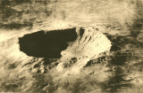
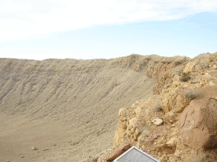
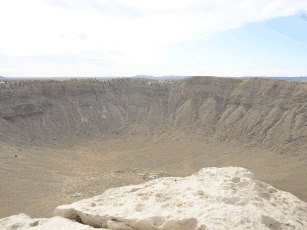
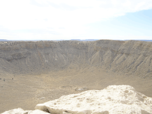
 The crater is a bit less than 200 m deep and is about 1.2
km in diameter. A 1929 aerial photo by the Smithsonian
Institute gives an overview.
The crater is a bit less than 200 m deep and is about 1.2
km in diameter. A 1929 aerial photo by the Smithsonian
Institute gives an overview.
By John Michael Williams
For readers interested in impact events, here are some photos of Meteor Crater, Arizona, the best preserved impact crater known on Earth. Pick a photo to open a higher-resolution reproduction.
I was able to visit this site for about an hour in early December of 2006. The time was late morning, on a clear, somewhat overcast day.
This crater is located in northern Arizona, about 30 minutes' drive east of Flagstaff, in high prairie country at about 1700 m elevation. It is accessible by a road running a mile or two south from I-40.
Although formed about 50,000 years ago, the crater is very well preserved in the arid desert climate of the American West. It was first identified as an impact crater by D. M. Barringer, who tried to mine the nickel-iron of the assumed impactor beginning in the early years of the 20th century. The impactor could not be found and apparently was pulverized and dispersed, deeply buried in microscopic fragments, upon contact with the ground. The land still is owned by the Barringer family and has been designated a national landmark.
A museum and visitor's gallery is perched on the north-west rim of the crater. There is a nominal admission charge to the crater itself, which is visible only as a low ridge at ground level from a distance. Excellent reference material has been posted online. A collection of aerial images is available, courtesy of NASA.
The crater is a bit less than 200 m deep and is about 1.2
km in diameter. A 1929 aerial photo by the Smithsonian
Institute gives an overview.
The impactor is believed to have been a nickel-iron solid mass or tight aggregation about 50 m in diameter arriving at about 20 km/s. Contact with the Earth's surface liberated energy approximately equal to that of detonation of 2.5 megatons of TNT.
Here is a panoramic sequence of the distant wall of the crater, looking south into the late morning sun:
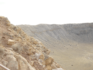
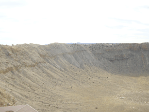
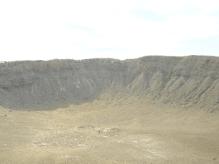
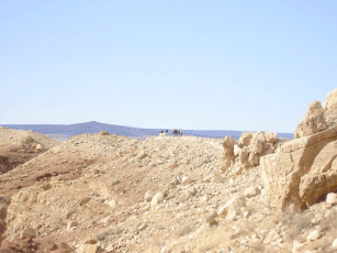
A group of visitors on a tour is visible on the crater rim at the center of the rightmost image.
If you can cross your eyes voluntarily, or have a
stereoscope, here is a stereo pair (3-D view) of
the floor of the crater.
You may have to download
and reverse the positions of the pair for correct
depth perception:
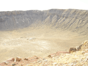
The barely-visible features at the center, also noticeable in other photos, are remnants of attempted mining activity.
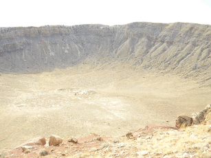
Here is another stereo pair of the crater floor:
Finally, some upraised stratigraphy can be seen in this view of the east side of the crater:

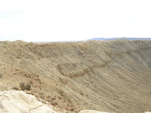
The impact elevated a layer of sedimentary bedrock. Flagstone, naturally occurring in flat slabs, is mined in the Flagstaff area for use in sidewalks and decorative garden walkways.
Fifty thousand years ago, an unexpected extraterrestrial visitor mined for us here a more interesting walk than any of could hope to have in our back yard or garden.
Back to Pulfrich Effect Home. University Privacy Policy
The Pulfrich Effect, SIU-C. Last updated 2007-04-14